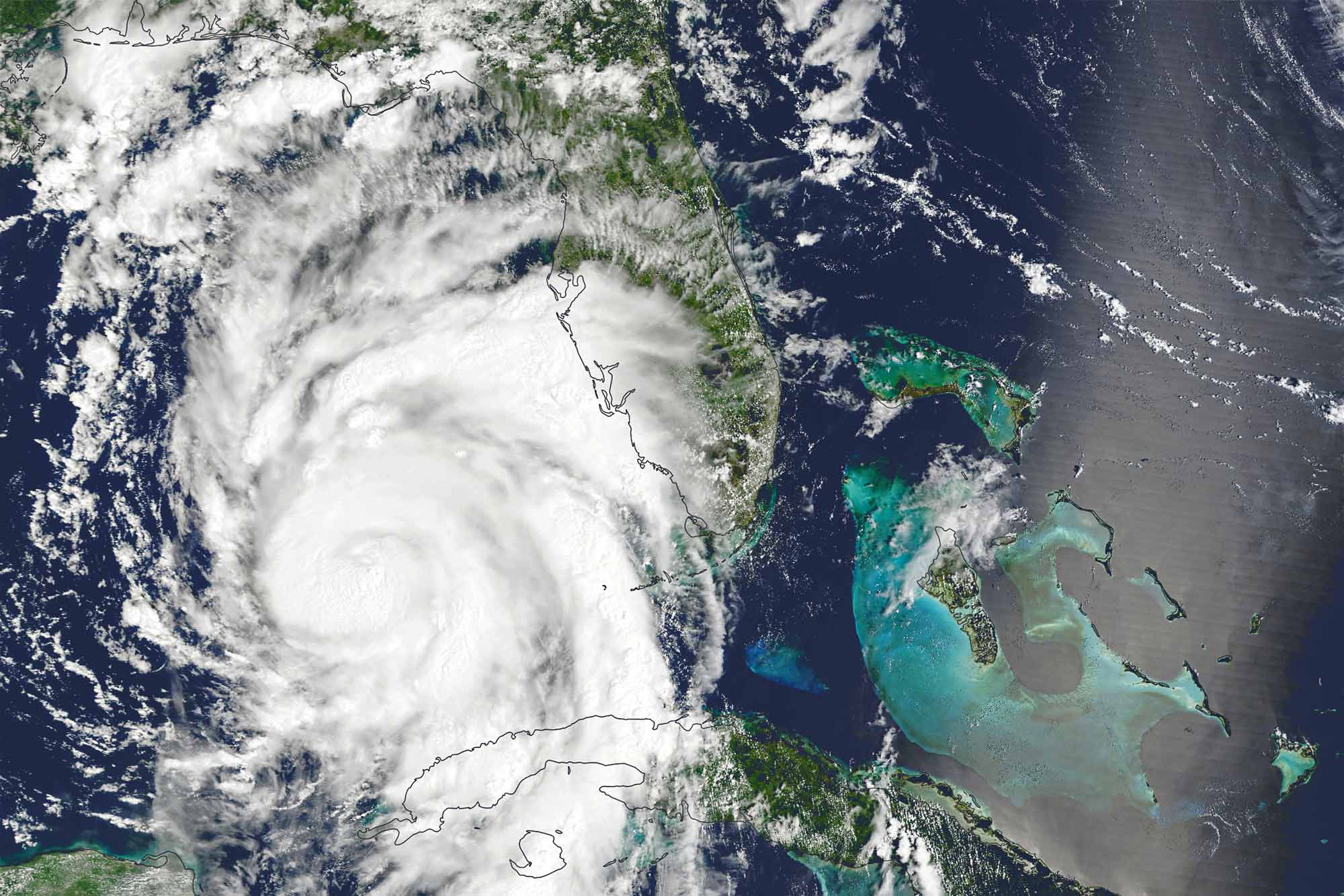
One of the hallmarks of the destructiveness of a hurricane is how much water it dumps on ordinarily dry land. As Hurricane Idalia intensified, resulting in major flooding even before it made landfall Wednesday, University of Virginia hydrologist Venkataraman Lakshmi was tracking it.
Roads washed out and homes and other structures were inundated. Idalia was upgraded to Category 4 overnight before notching down a category as it came ashore in Florida’s Big Bend region.


The professor explained how the hurricane built so quickly in such a short time, and what’s next in terms of the water’s potential harm.
What Fueled the Hurricane
Lakshmi, a civil and environmental engineering professor who is a frequent commentator in the media and president-elect of the Hydrology Section of the American Geophysical Union, said that the category of a hurricane is what matters in terms of impact.
Category 4 storms forecast 13 to 18 feet of ocean surge. Idalia was a Category 3 storm prior, as well as when it hit land, forecasting 9- to 12-foot surges of water.
Yet, it had just become Category 1 on Tuesday. Lakshmi said heat drove the hurricane.
Idalia grew because of warming conditions in the ocean, in particular a naturally occurring phenomenon called El Nino, which is born from higher water temperatures. Interactions between water and the atmosphere then begin to shift air currents.
“This year in June, the El Nino began, and as a result there is greater wind shear in the Atlantic Ocean,” Lakshmi said.

Ordinarily, though, wind shear in the Atlantic would suppress hurricane activity, he said.
“A calm atmosphere helps to create a stronger hurricane, and this wind shear disturbs the atmosphere,” he said. “On the other hand, in July, the water off the Florida coast was measured to be 100 degrees Fahrenheit – way too warm. Warm waters help fuel a hurricane by increasing evaporation into the system.”
The two opposing mechanisms of wind shear and warmer water near land, dynamically interacting with each other, created the cycle that intensified Idalia’s strength.
The coastal storm surge guaranteed that buildings closer to shore would be partially or fully submerged, of course, and large swaths of sandy coast would be rearranged, he said. But destruction further inland was guaranteed, too.
What’s Next: Water Damage Dangers
Lakshmi noted that the immediate flooding is just the beginning of the danger for residents. Structural uncertainty is another major concern.
“Increased water levels adjacent to houses and other buildings increases water pressure, and water seeps into foundations and basements, undermining their integrity,” he said. “Actual increase in the water table may also happen – for example, more saltwater may intrude into a coastal aquifer – but this is minor compared to seepage into basements.”
He said the water also undermines structures such as bridges and piers. Officials will know more about the full impact in the days and weeks ahead.
The professor added that just because one hurricane may be a higher category than another historically, that doesn’t necessarily mean it will bring more flooding or other devastation. A lot depends on where it makes landfall.
Media Contact
Communications Manager School of Engineering and Applied Science
williamson@virginia.edu (434) 924-1321
Article Information
September 28, 2025


