University of Virginia terrestrial ecologist Howie Epstein has won a $607,000 NASA grant to use Earth-observing satellite data to assess how vegetation diversity is changing in the Arctic tundra.
Epstein, a professor of environmental sciences, has for much of his career conducted research, both on the ground and via satellite, on tundra regions – cold, extreme northern latitude areas where windswept plains are treeless, but a variety of low-lying, clustering plants have adapted to the environment. He has particularly focused in recent years in Siberia. Using old spy satellite data from the 1960s, and comparing it to more recent imagery, he and his graduate students and colleagues have determined that tall shrubs, such as alder, willow, birch and dwarf pine, have expanded their range and grown taller, indicating that the tundra is undergoing change, likely as a result of increasing temperatures and loss of permafrost.

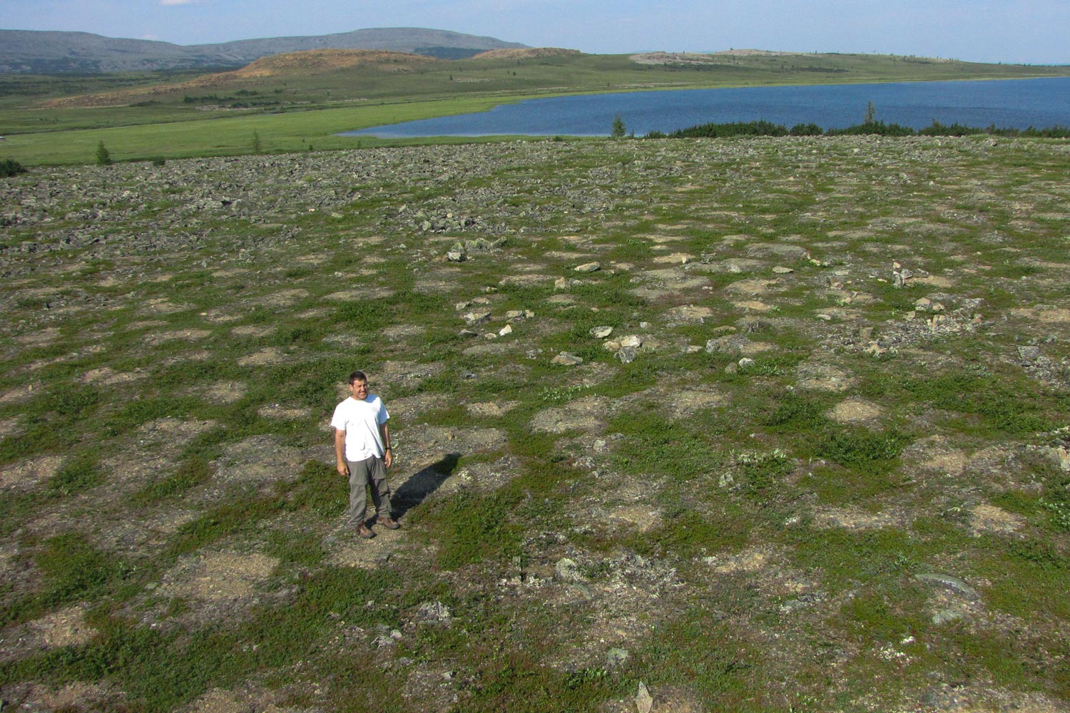
Epstein conducts vegetation sampling on the Siberian tundra. (Submitted photo)
Epstein recently discussed his research for UVA Today readers.
Q. Why should we care about what happens to Arctic tundra?
A. Changes to the Arctic region cause changes to global climate, which affect every region on the planet. Reduction in sea ice in the Arctic Ocean and loss of the permafrost on land, which are both happening at an increasing rate, alter weather patterns elsewhere, including in the U.S. Likewise, changes in other regions, and to the global climate, affect the Arctic region, causing further warming.
Q. What changes are occurring to Arctic tundra?
A. There is a general greening of the landscape as temperatures increase and the permafrost is reduced in the region. This results in an alteration of the types of vegetation across the tundra. That also affects the migration patterns of wildlife, including caribou and musk ox, as well as the types of birds, rodents and insects that occupy the tundra landscape. All of this affects the lives of indigenous and non-indigenous people who live in those areas.
One of the biggest concerns is that as the permafrost thaws over increasingly longer summers, an enormous amount of carbon dioxide currently stored in dead organic matter in the soil could be released to the atmosphere, which would further contribute to the warming of the planet and affect regions far from the Arctic Circle. That is a big scientific question – what will happen to the permafrost over time, and how much carbon would enter the atmosphere; what will the long-term effects of that be?
Q. What is the goal of your newly funded research for NASA?
A. Our goal is to use satellite data to analyze the whole Arctic tundra and develop classifications of vegetation types and how they function in the ecosystem broadly, as compared to what we’ve done thus far, which is primarily trying to determine what plant species are there.
The point of this is to better understand what the vegetation is doing, how the different types function – which affects the balance of plant and animal species – and to create new maps that demonstrate vegetation function. When the climate of an ecosystem changes, the functioning of its vegetation and species distribution will change in response. We want to understand how and where that is happening.
The satellite imagery we plan to use provides resolution to 250 meters [or 0.16 miles], which allows us to classify each pixel based on how the vegetation is operating, giving us a good understanding of the functional diversity across large areas, and how it varies, what’s homogeneous in function and what’s variable.
We will be able to overlay maps we’ve already developed of plant communities and, by looking at new maps of vegetation function, we should be able to determine if there are areas with the same vegetation, but that are doing different things, and areas with different vegetation types, but behaving similarly.
Bottom line: it’s a new way of looking at biodiversity; the way the vegetation is operating, as opposed to the way it’s structured by species. This can tell us a lot about responses on the ground to changing climate that occur prior to actual changes in the composition of vegetation species.
Q. How is that important?
A. By identifying functionally rich areas, what we call “hot spots,” we can target conservation efforts toward those areas. The data also will show how different functional types are grazed differently by migrating caribou. This can help in the conservation of these functionally rich areas as oil and gas exploration and extraction increase in the tundra regions.
Sea ice is melting, which is opening up the Northwest Passage and other routes to shipping, and as the tundra also warms, the Arctic becomes more accessible to development and human population growth, which will affect the people who already live there, particularly indigenous populations. Hopefully the most functionally important areas of the tundra can be set aside for preservation. It’s a beautiful region of our planet that supports an array of beautiful mammals, birds and insects.
Media Contact
Article Information
May 7, 2018
/content/qa-gaining-birds-eye-view-greening-arctic

